Skip to content

The purpose of this repository was to highlight my skills in using Javascript to read JSON data, Leaflet to display a map visualization, and HTML to successfully load an interactive map into my browser.

Notifications You must be signed in to change notification settings

mbreitner/Mapping_Earthquakes

Repository files navigation

Mapping_Earthquakes

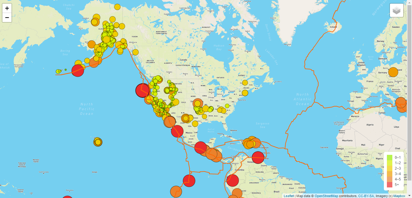
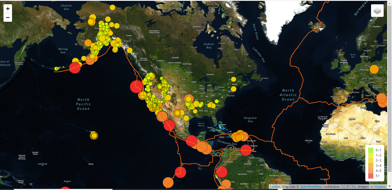
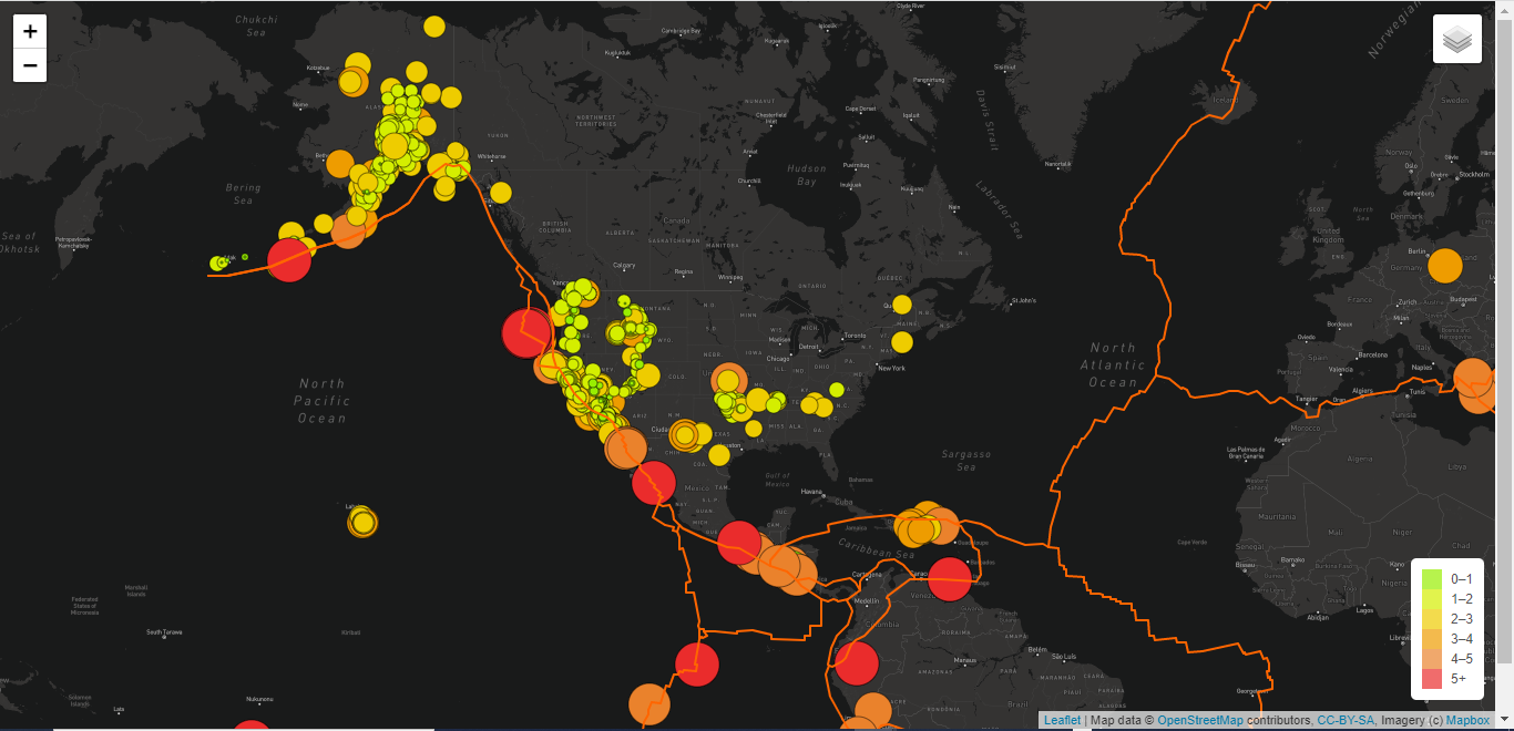
The purpose of this analysis was to continue utilizing my skills to use Javascript to read JSON data, Leaflet to display a map visualization, and HTML to successfully load the map into my browser. I added additional code to create three more maps to detect 1. tectonic plate locations 2. earthquakes with a magnitude higher than 4.5 and 3. adding an additional layer to include a dark colored map.

Street View

Street View Earthquake Map

Satellite View

Satellite View Earthquake Map

Dark View

Dark View Earthquake Map

About

The purpose of this repository was to highlight my skills in using Javascript to read JSON data, Leaflet to display a map visualization, and HTML to successfully load an interactive map into my browser.

Topics

Resources

Stars

Watchers

Forks

Releases

No releases published

Packages

No packages published